Toronto just got a bunch of new land
Becky Robertson
created: April 28, 2025, 2:22 p.m. | updated: April 29, 2025, 3:06 p.m.
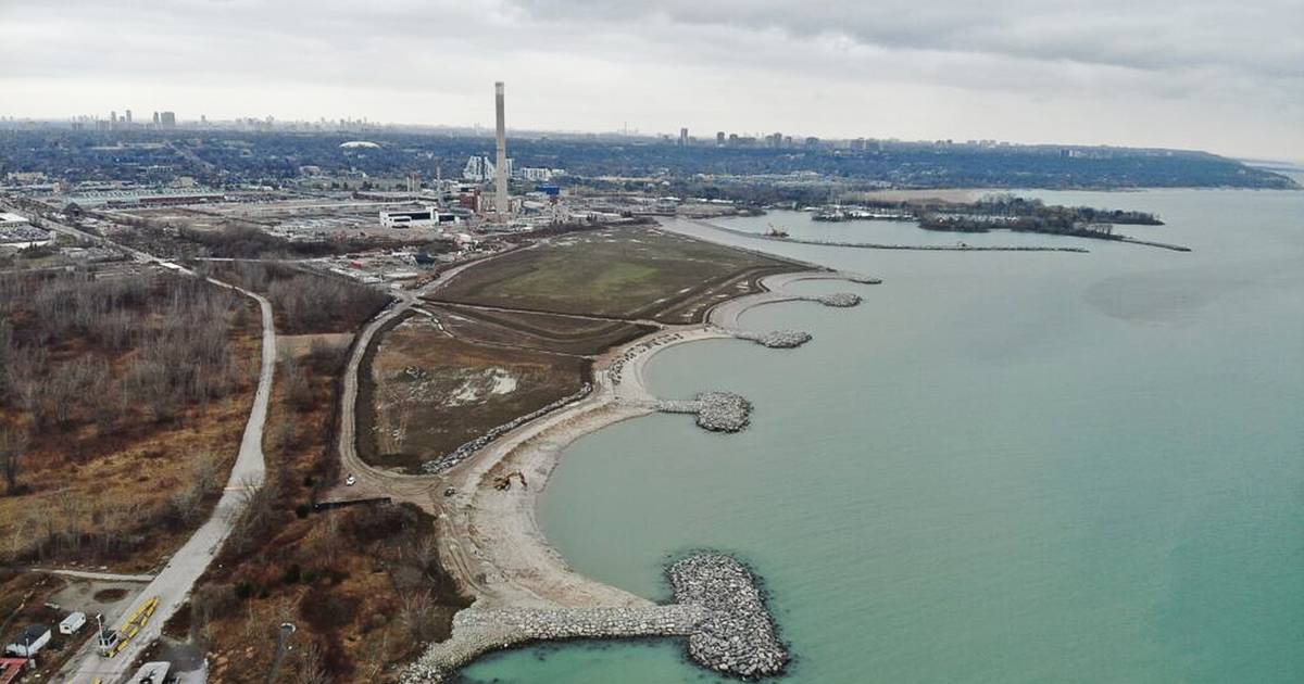
The Ashbridges Bay Landform Project involves, as its name suggests, adding physical land to the city's southernmost edge to help prevent ongoing erosion and stabilize the beach.
The project aims to manage sediment that, for years, required regular dredging to allow boats to pass, and to enrich and preserve the local ecosystem.
All of this has made for a completely new shore that even appears different on maps, pushing the city's bounds out further into the lake.
To put it into quantifiable perspective, the TRCA says in an update that in total, it added a whopping 14,527 square metres of cobble shoreline, 7,800 square metres of gravel and rip rap material, 6,170 square metres of underwater habitat shoals (plus another 3,142 square metres of submerged trees for the local ecosystem), and 5,036 square metres of naturalized shoreline area, including aquatic plantings.
Particularly interesting is the fact that some of this material came from various City of Toronto tunnelling projects, meaning that dirt dug up from an across-town portion of, something like the Ontario Line, is now taking on a new life serving a new purpose in Ashbridges Bay.
1 month, 1 week ago: blogTO